Brief introduction to orienteering in Horton Grove
Horton Grove is a 708 acre nature preserve north of Durham and managed by Triangle Land Conservancy. We will stage October’s event from its main parking area, which has space for approximately 25 cars, and is located at Latitude 36.142298, Longitude -78.843700. Nice weekends during the pandemic have brought relatively large crowds, and the lot can fill up — so consider carpooling if possible. There are no bathroom facilities, no trash cans, no electricity, and no running water.
The terrain is typical ridge/valley and is generally quite gentle, although there are short stretches of unclimbably steep earth banks that are adjacent to the park’s two main north/south streams. Vegetation thickness varies considerably. While probably at least half of the preserve offers beautiful open runnable woods, small but significant areas have thick vegetation, including a few patches of truly impregnable bramble. The heavily-vegetated areas are likely the parts of the preserve that were used agriculturally in the 1800’s on the (now historic) Stagville Plantation.
Map scale is 1:10,000 with a contour interval of 2.5 m. Vegetation thickness on the ground will unfortunately tend to be a bit thicker than what is mapped. I’ll apologize in advance for route choices that take you through unexpected vegetation. Half of my excuse for this will be that I started this map in the winter, when much of October’s vegetation was nonexistent. The other half of my excuse is that vegetation mapping is very hard, and I am not yet that great at it.
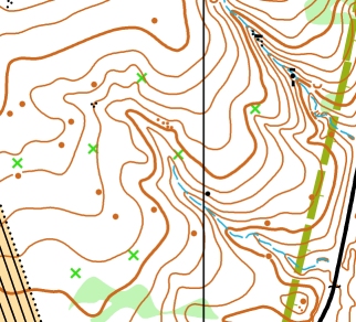
There are relatively few rocky features on the map, and as a result most of the mapped point features are knolls and rootstocks. These were not mapped exhaustively, and in general were included only if I thought that they might make a good future control location. Because not all of these features were mapped (especially smaller ones) you should take caution in using them for relocation. Rootstocks are mapped with a green ‘X’, and a green ‘O’ is used for significant or stately living trees.
Park boundaries are mapped with a thick olive line. These lines are based on Durham Co. GIS data, and are generally not marked on the ground. In fact, you may see some obsolete boundary markers that indicate a former border beyond which the park has expanded. It is not advisable to stray outside of the park boundaries because there many signs of active hunting in these areas. Triangle Land Conservancy allows hunting in a far eastern section of the preserve; but we have been assured that hunters are not allowed there on the Sunday of our event.
[…] Check-in at the main parking lot (GPS coordinates = 36.142298, -78.843700) to receive your map. Please note that Horton Grove has no bathroom facilities, running water, or electricity. You can read more about orienteering in Horton Grove here. […]