Orienteering Site Selection
Would you like to orienteer closer to home? Do you know of a great place for a new orienteering map? Let us know! But before contacting us, please look over these important considerations when establishing a new place for orienteering.
1. The venue. In general, orienteering events require a lot of space. Is your proposed venue large enough? For short events (e.g., ‘sprints’) a campus or city park may provide a great potential location, although any such event generally needs at least 90 acres (0.4 km²). For standard forest orienteering, a large wooded area (at least 400 acres [1.6 km²]) is really a necessity. In addition to a large size, a proposed orienteering venue should provide enough interesting features to make courses fun and different from meet to meet. For sprint maps, features such as buildings, fences, potentially-confusing roads and paths, and pockets of vegetation are perfect. For forest maps, a new venue should have a lot of interesting terrain and rock features such as gullies, knolls, boulders, and cliffs, as well as a variety of vegetation differences. Of course, if the vegetation is too thick or the land is too steep, no one will enjoy running around in it. Finally, the landowners have to give permission and there needs to be adequate parking facilities for the proposed use.
2. The map. Orienteering maps are exceptionally detailed, and creating them takes time, effort, and money. The figure below illustrates four common maps of the same area of Umstead Park in Raleigh, NC.

Google Map
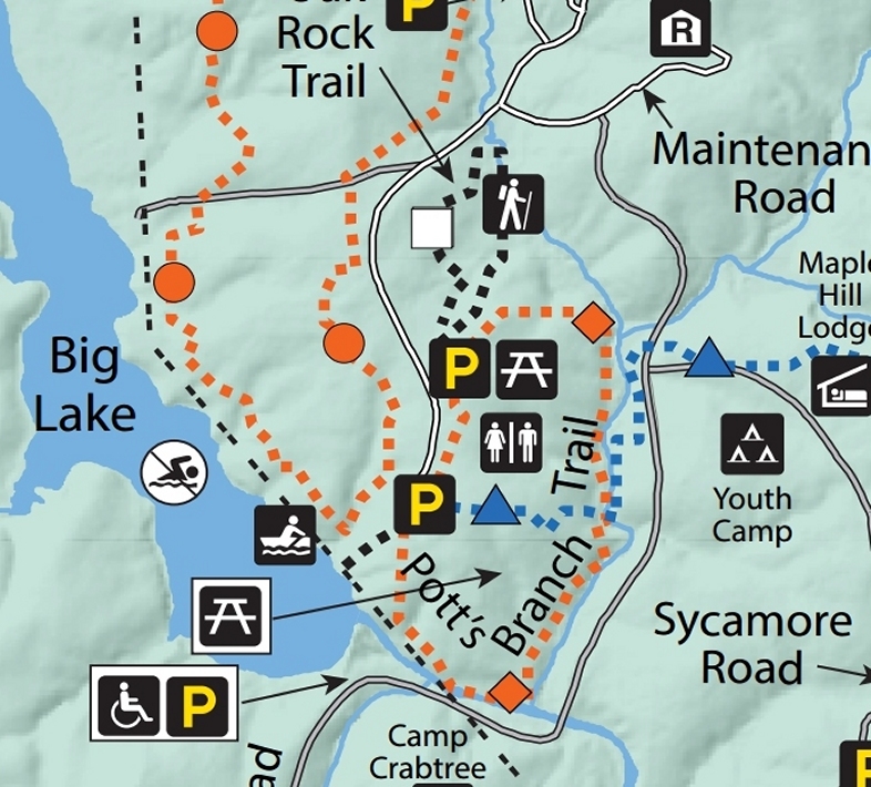
Park Map
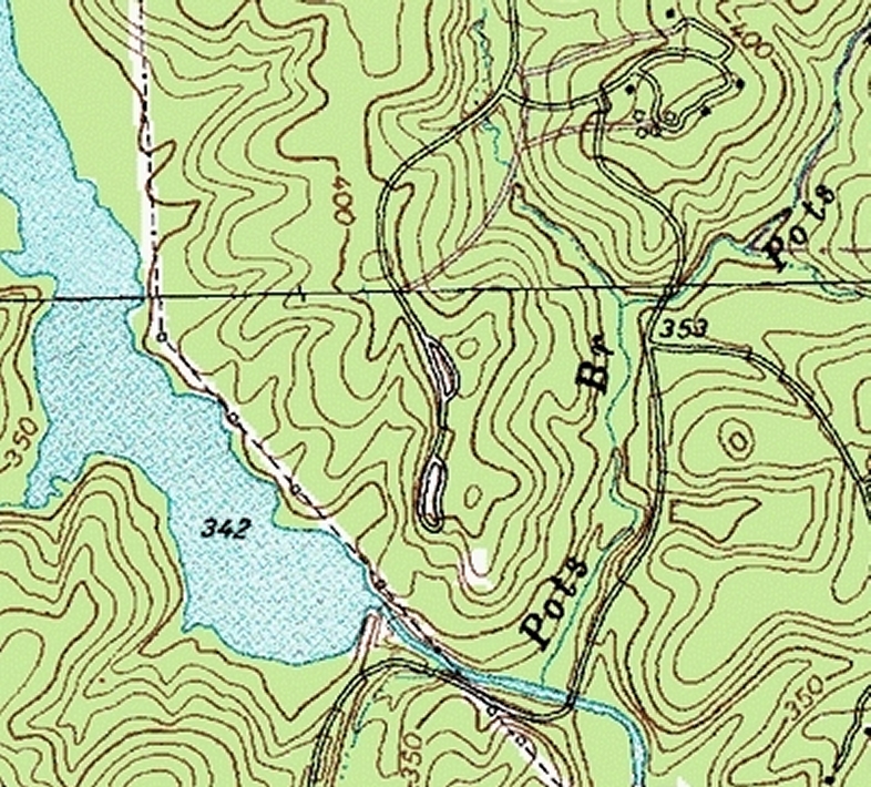
USGS Map
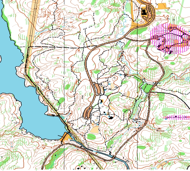
Orienteering Map
Although each map has a useful function, only the orienteering map depicts all of the details that would be necessary for making informed navigational decisions on foot: terrain relief, vegetation, water and rocky features, roads, trails, buildings, and special items. Although online resources can provide good aerial photographs and detailed information about the terrain, these and all other aspects of the map must be thoroughly field-checked by an expert mapper who walks carefully through the area. Depending on the terrain, a good mapper may require one complete day just to cover 30 or 40 acres. Hiring a professional mapper can thus cost quite a bit of money; and relying on club volunteers for mapping can cost quite a bit of time. It is rare for a club to produce a good usable orienteering map in less than one year.
3. Permissions and other uses. The property owners and managers for a proposed orienteering venue must be contacted before mapping begins and must agree both to have their area mapped and to allow future orienteering events. Some forest managers do not allow off-trail use. Others do not know about orienteering or have misconceptions about its environmental impacts. These issues all need to be ironed-out and an agreement reached before the club invests its efforts in creating an orienteering map. Similarly, one would need to know beforehand how and whether local hunting regulations would impact orienteering.