July 26th, 2026
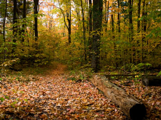
We will have an open event at Bond Park (in Cary) on Aug 2, 2026. Registration will be at a picnic table near the boat house. If the parking lot near the boat house is full, please be ready to park in any other parking lot (there are plenty) and walk back to the start.
Register Here
This event is open to all skill levels. Start anytime between 10 am and 1.30 pm. Courses close at 2 pm when we start picking up controls. Be sure to check in at the start/finish after your course so we know everyone made it back.
There will be 3 sprint courses available and you can run as many as you want in any order:
Sprint A – 2.6 km (Yellow-Orange level – not exactly a sprint, but not quite middle-distance)
Sprint B – 2.1 km (Yellow level)
Sprint C – 1.5 km (White level)
In addition to the sprint courses, we’ll have a 70-minute Memory-O course/challenge. It works just like Score-O, but you won’t be given a map. Instead, a map with the controls will be placed on a table at the start, and you’ll need to memorize it to find the controls in the park. You can return to this stationary map as many times as you want (within your 70-minute time limit) to refresh your memory. Each control you find is worth 10 or 20 points. However, there will be more controls in the park than on the Memory-O map — if you punch one that isn’t on the map, you’ll get minus 5 points. The penalty for being late is 10 points per minute. If you choose to do Memory-O, you must do it before running the sprints.
Beginners may prepare themselves by watching the videos on our Newcomer Information Page. If you need additional instruction or have questions, please ask one of the BOK volunteers at registration.
We always appreciate help with control pickup.
Tatyana and Vladimir
July 5th, 2026
We picked an earlier start time (on a Saturday!) in an attempt to beat the heat. I believe the heat still won overall. The park is a bit challenging, with all the construction going on. A lot of fences had to be mapped, and even within the week of the event there were significant changes […]
Read More
June 17th, 2026
Memory-O was a success and proved to be a real challenge for orienteers. It turned out to be less about speed and more about strategy, confidence, and spatial memory. No one managed to clear the course, though several people came very close. Decoy controls also played their part. In the end, Brian Thompson and Matt […]
Read More
June 15th, 2026
On Saturday, June 27, we will be holding a Sprint orienteering event at Dorothea Dix Park in Raleigh. You can start any time between 10:00AM till 12:00 noon, and everybody must finish by 1:00PM.
The start and finish will be near the gazebo on Umstead Drive (35.771244, -78.661292), 125m West of Hunt Dr.
All skill levels are welcome. If this is your first time orienteering, please consult our instructional material.
Please be aware there are controls around the cemetery, which is out of bounds. The cemetery has pink bars on the map and has physical white posts on its border. Please be respectful of the cemetery. Do not run inside the white posts; even to cut corners.
There have been significant changes to the park in the past year, and there’s active construction. We did our best to update the map with the new fences, but there is a high possibility the map is still incomplete.
There will be 2 sprint courses of approximately 2.4km each. You will be able to run any or both of them in any order.
There will also be a Map Explorer course, with all controls. You can navigate this course at your own pace, pick up controls in any order, and as many as you like. The only requirement is to be back by course close time (1:00PM).
You must register here for this event before Friday, June 26 at 5 PM.
May 19th, 2026
We will have an open event at Lake Crabtree County Park on June 7, 2026, (1400 Aviation Pkwy, Morrisville, NC 27560.). Registration will be at picnic table between Beech Shelter parking lot, the boat house and volleyball court. Follow BOK signs – take a trail from the parking lot down to the lake and you won’t miss the start.
Register Here
This event is open to all skill levels. Start anytime between 10 am and 1.30 pm. Courses close at 2 pm when we start picking up controls. Be sure to check in at the shelter after your course so we know everyone made it back.
There will be 2 sprint courses available and you can run one or both of them in any order:
Sprint A – 1.5 km (White-Yellow level)
Sprint B – 1.7 km (Yellow level)
In addition to the sprint courses, we’ll have a 45-minute Memory-O course/challenge. It works just like Score-O, but you won’t be given a map. Instead, a map with the controls will be placed on a table at the start, and you’ll need to memorize it to find the controls in the park. You can return to this stationary map as many times as you want (within your 45-minute time limit) to refresh your memory. Each control you find is worth 2 points. However, there will be more controls in the park than on the Memory-O map — if you punch one that isn’t on the map, you’ll get minus 1 point. The penalty for being late is 1 point per minute. If you choose to do Memory-O, you must do it before running the sprints.
Beginners may prepare themselves by watching the videos on our Newcomer Information Page. If you need additional instruction or have questions, please ask one of the BOK volunteers at registration.
We always appreciate help with control pickup.
Tatyana and Vladimir