2017 Bubbagoat & Chapel Hill Score-O
Important note: Daylight savings will end at 2:00 AM on Sunday. The time change won’t affect the Bubbagoat, but the Chapel Hill street-O that starts at 10:00, noon, or 1:00 will seem more like 11:00, 1:00, and 2:00, respectively. If you miss the time change, you will have an extra hour to study your map!
Update: Maps to start locations updated. Bubbagoat map is here. Street-O map is here.
Update: Start, Finish, and Registration for the Chapel Hill street-O will be at the park shelter at Hargraves Community Center. See map here. (GPS coordinates = 35.912760, -79.063038). Unfortunately, there is a good chance that this location will not have bathrooms available until around noon. The meet director will inform registrants of possible bathroom availability at nearby restaurants or churches (or in nearby bushes).
Update: The Saturday goat event will now offer an advanced (orange) level course for the general public. There will not be beginner or intermediate (white or yellow) courses; but anyone who has completed an orange course in the past is welcome to attend. Standard meet fees apply, and if you’re coming with a group of 5 or more, please pre-register here.
On November 4 and 5, BOK will offer two long events: a ‘Bubbagoat’ at Eno River State Park, and an urban score-O through the streets and green spaces of Chapel Hill/Carrboro. Both events will have multiple length options (Saturday: Bubba- Pygmy- and brown course & orange; Sunday: 1-, 2-, or 4-hour score courses) and bikes will be allowed on the Sunday score course.
A ‘goat’ race is a long and sometimes grueling orienteering course with several unusual rules that make the event especially fun. Listed here are some general features of goat races, followed by specific information about the Bubbagoat on November 4 and the score-O on November 5.
- Mass start. A goat race is a mass-start event. Be sure to get to the start on time (noon) because if you’re late, your place will be based on the mass start time — not the time that you take off.
- Following. Following other competitors is explicitly permitted. However, please be aware of the possible disadvantages of following other runners.
- Skipped controls. Each competitor is allowed to skip at least one control. Rules about which controls can be skipped will be given at the briefing session 15 minutes before the race. Note that skipping a control will make your course somewhat shorter than the advertised distance for the entire course.
- Forked controls.There may be one or more sets of forked controls on both the Bubba and the Pygmy goat courses. A forked control is one in which a competitor can choose which of two routes to take. As an example, let’s say that you get to control #6 and there is a fork going to two different #7 controls. On your map, lines to both #7’s would be shown, and the controls would be labeled ‘7A’ and ‘7B’. You would be able to decide which #7 you wanted to do — you should not go to both. It is possible for more than one control to be involved in a fork. Thus, to continue the example, 7A may lead to 8A and 7B may lead to 8B before joining back up at #9. Once you choose a direction on a fork, you will need to stick with it (e.g., do NOT do 7A and 8B). Eventually, both forking choices will rejoin back into a single course.
- Length and difficulty.Traditionally, a goat race has the length of a long (blue) course — 10 – 15 km. However, the difficulty level is typically not always at “expert”. Intermediate and advanced (orange) level controls are quite normal. Befitting the idea of a ‘goat’ race, courses are generally designed to have as much climb as the terrain realistically allows.
BOK’s 2017 Bubba Goat
- Preregistration and Shirts. All competitors must preregister (see below) for all events. {Registration deadline has passed for a shirt.}
Shirts will be available (for $15) for all competitors of the Bubba and Pygmy goat (and for volunteers) who preregister before 5:00 PM on Monday, 23 October (people who do the brown or orange course will not receive a t-shirt). Note that this is a firm deadline that we need to enforce strictly in order to place our t-shirt order with the printer.People who register online after 23 October but before 5:00 PM on Thursday, November 2 will be able to compete, but will not get a t-shirt. This is an “expert” level members event, open only to BOK members who have completed a brown, green, red, or blue course. Members of other orienteering clubs besides BOK are encouraged and welcome to participate, but will need to pay $5 per event (in addition to the optional shirt fee) to help cover our expenses. Non-members may sign up for the orange (advanced) or brown (expert) course. Note that finger stick rental is available for people who do not have their own SI card. The rental fee will be $5, on top of the fees above. Volunteers for the event who would like a t-shirt should also register before the deadline, writing a brief note to the organizer that you will not be running and would prefer to help out. Volunteers will be especially appreciated to help with control pickup. T-shirts will by Augusta Sportswear and printed by AHPeele in Raleigh. Sizes: Adult unisex / male, S, M, L, XL 2XL unisex / male size chart $2 extra for 2XL. Adult female cut, XS, S, M, L, XL female size chart. Presented here is the preliminary design for the shirt.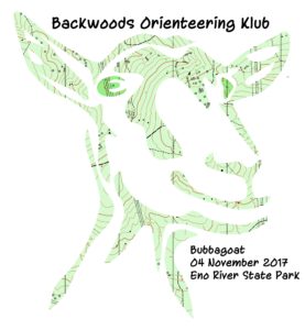

— Scroll to the bottom to register for this event —
- Schedule. Competitors for the Bubba and Pygmy goat races should be at at Dewitt cabin (across the footbridge from the parking lot) and ready to run by 11:45 AM. Plan for a 10 minute walk from the parking lot to the start. See map here. At 11:45, the event director will review the rules and will provide important information about the race. Do not miss this briefing session. Maps will be distributed just before the briefing, and competitors will not be allowed to look at them until after the start. Maps will be pre-bagged, but not sealed. Control descriptions will be provided on the map; they will not be available as separate sheets. The brown course will be open between 12:10 and 3 PM. All competitors must be off their course by 4:00, when control pickup will begin.
- Course lengths (not including skips). Bubba Goat = no more than 11.9 km (with 510 m of climb); Pygmy Goat = 5.2 km (with 225 m of climb); Brown course = 3.7 km (with 110 m of climb); Orange course = 4.3 km (with 130 m of climb). It will be permissible to switch from the Bubba to the Pygmy goat (but not vice versa) after the start, and instructions about how to do this will be given during the briefing.
- Camping: If you’re coming from out of town and plan on staying in Raleigh/Durham for the weekend of BOK orienteering opportunities, camping is available at Eno River state park. Click here for more information.
- Course setter notes.
Map and venue information: Maps for all courses will be printed at a scale of 1:10,000 with a 5m contour interval. Bubbagoat maps will be printed on 11″ x 17″ pages. Pygmygoat and brown course maps will be printed on 8.5″ x 11″ pages. Overprint color will be bright scarlet. The Bubbagoat map will show a magenta line that indicates how to switch from the Bubba to the Pygmy course.
Approximately one-third of the Bubbagoat race will be in newly-mapped areas of the park that have never been used for orienteering. With very few exceptions, the woods at Eno River are exceptionally runnable, and there is very little green on the map.
Tentative Course information: The Bubbagoat will have 22 controls; the Pygmy will have 14; and the brown course will have 7. All courses will have at least one optional (depending on route choice) river crossing. These potential crossings will be near fords or bridges; however, even the fords on Eno River can have swift currents and rocky/slippery spots. Depending on conditions, the meet director may forbid crossing the river on foot. Currently, two controls on the Bubbagoat course and one control on the Pygmy course are planned to have drinking water (and skittles). Competitors who don’t want to take a chance on the availability of drinking water (or skittles) on their course are advised to carry their own.Finally, note that a 10-minute bonus will be given to any competitor who completes his or her course in denim overalls.
Questions about the goat? Contact Dave at dw.orienteer <at> gmail.com
The inaugural Chapel Hill Street-O
- Preregistration: All competitors must pre-register for this event (see registration form below) before 5 PM on Thursday, November 2. If you register after this time, you cannot be guaranteed a map. This is an ‘advanced’ level members event that is open to all BOK members who have completed an orange, brown, green, red, or blue course. Advanced members of other orienteering clubs and active US military personnel are encouraged and welcome to participate for a $5 fee that helps the club cover its costs. Competitors who plan to go out in a group should each register separately for the event. Note that fingersticks will not be necessary for this event.
— Scroll to the bottom to register for this event —
- Schedule: Start, finish, and registration will be at the park shelter at Hargraves Community Center. See map here. (GPS coordinates = 35.912760, -79.063038). Unfortunately, there is a good chance that this location will not have bathrooms available until around noon. The meet director will inform registrants of possible bathroom availability at nearby restaurants or churches. There will be three separate mass starts — at 10:00 AM, noon, and 1:00 for the 4-, 2-, and 1-hour races, respectively. Note that these start times are designed to give the same 2:00 cut-off time to all competitors, increasing the potential for post-race socializing. (It is likely that competitors in the 2- and 1-hour events will have to manually punch their start box, creating a few seconds-worth of differences in their cut-off times.) Maps will be distributed at least one hour before each start time to provide time for competitors to plan their routes. There will be an important mandatory briefing 10 minutes before each start.
- Course lengths: All courses will use the same maps. The straight-line distance optimally connecting all controls will be approximately 28* km. (Note however that a Minkowski distance exponent of 1 is more appropriate than 2 for an urban street-O – competitors who are able to clear the course will inevitably travel significantly longer than 28* km.) It is not expected that competitors on foot will be able to clear the course, but the course designer would greatly enjoy seeing this expectation fail.
- Bikes: Competitors may do their course on bike, foot, or any combination. Places that are known to be unsafe for bike travel or are off-limits to bikes will be marked on the map. However, no claims are made about the completeness of this mapping. Bike competitors will need to use their judgment and discretion during the event to stay safe. Competitors who prefer to bike but don’t own one, or who anticipate difficulties transporting their bike to the event, may be able to rent a bike from a local bike shop. Details about this option will be sent out as they become available.
- Course setter’s notes:
Map and venue information. Each competitor will get two maps: a 1:20,000 street map of the entire course, and a 1:10,000 map of the central downtown/campus area. The larger map will be printed on an 11” x 17” page; the smaller on 8.5” x 11”. Contour interval is 5m. Overprint color is bright red. Because of its scale, the map cannot include the same detail (e.g., knolls and ditches) as a forest orienteering map; and much of the map has not been thoroughly field-checked. Moreover, a number of colors and symbols will be different from those of a typical orienteering map. For example, magenta lines will indicate places where bikes will have difficulty, or are prohibited from, travelling. Pink areas represent public schools. The legend for the map appears below. It will help competitors to have studied it before coming to the race.

Tentative Course information. Controls will not be marked by an orienteering flag. Rather, when a competitor gets to the center of each circle, there will be an object in plain sight (e.g., a statue). Competitors will carry a separate clue/answer sheet that asks a question about this object, and will write down the answer to its question before traveling to the next control. Therefore, it is critical for each competitor to carry a waterproof pen or pencil to write down their answers. Each control will be worth between 2 and 8 points, depending on its distance and difficulty. The first digit of each control number will indicate its point value (e.g., control #46 is worth 4 points.) Winners will be those who accumulate the highest point total after deducting possible penalty points for being late. The late penalty will be 8 points for the first minute and one point for each minute thereafter. Six winners will be recognized: one for each time (1-, 2-, and 4-hour) and travel method (foot, bike) combination.
There is a large amount of private property in the area, and competitors are prohibited from traveling on it. Competitors must stay on public roads and in public greenspaces. Refreshments will be available at numerous places in the area, but many will require payment. For example, competitors may want to stop at a convenience store during the race to pick up a sports drink. Some of these locations will be indicated by a blue circle on the map; however, many more will not be mapped. Competitors on the 2- and 4-hour courses will probably want to carry their own water or else carry money to purchase refreshments on the course.Group members must stay within audible contact of each other.
Questions about the score-O? Contact Dave at dw.orienteer <at> gmail.com
[cforms name = “Registration Multi Event (copy of form #2)”]
[…] Read preliminary information about two fun local orienteering events in early November by clicking here. […]